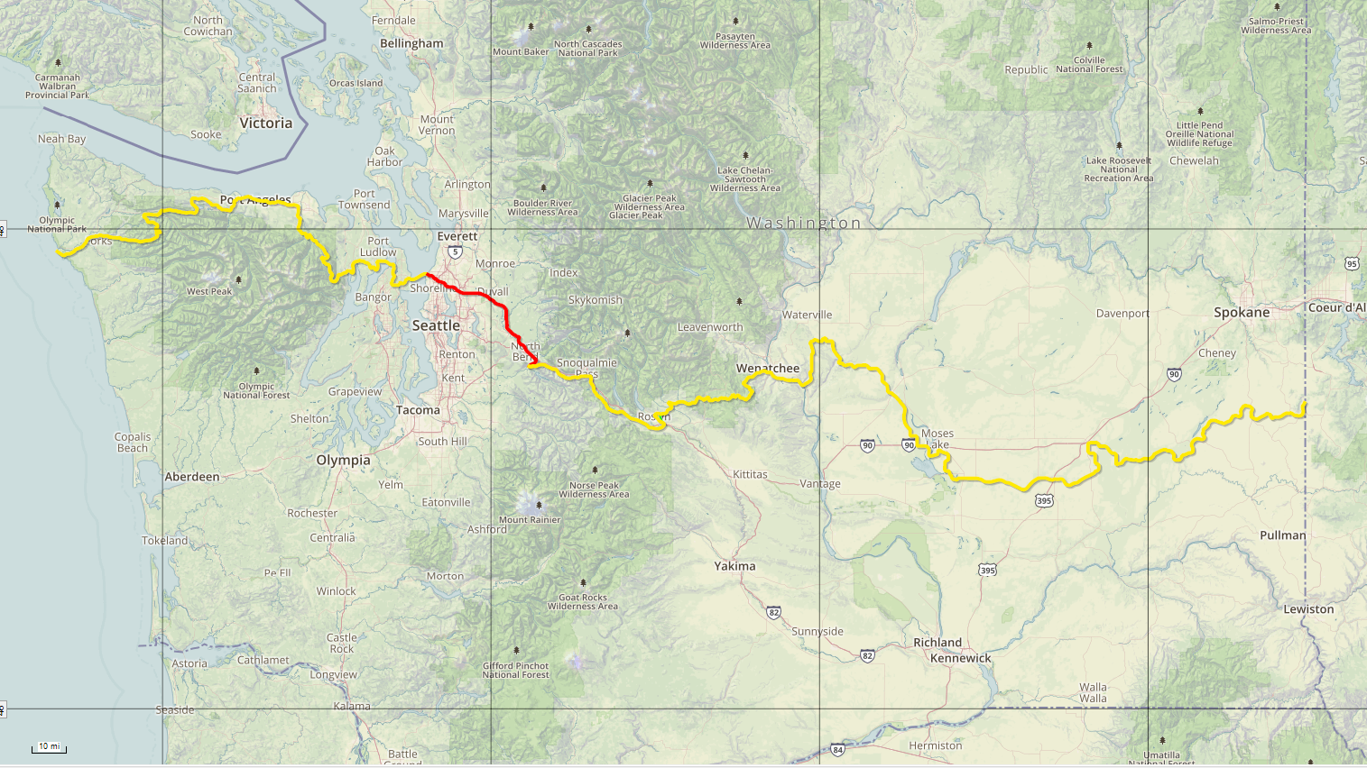
While the Cross-Washington Mountain Bike Route pops in and out of several cities and towns, there is one stretch that passes through the heart of suburbia. This segment covers 60 miles from Edmonds on the shore of the Puget Sound to Rattlesnake Lake just past North Bend in the Cascade Foothills. On paper this segment doesn’t seem that difficult. But there are many short and steep climbs that will challenge even the freshest of legs.
This section is also the most difficult to navigate. There are more turns in this 60 mile stretch than the rest of the route combined. Pay close attention to the route as you negotiate the turns.
If you’re a beer drinker then you will love this segment. The route passes directly by multiple quality breweries.
The Cross-Washington Mountain Bike Route passes through suburbs north of Seattle. Where one would normally expect congested streets and miles of pavement, there is a surprising amount of dirt. Also, for such a populated area, there are very few resupply options on route.
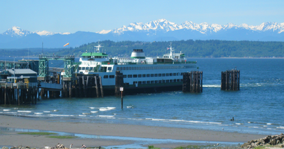
Following the course Eastbound, the ferry will drop you off in Edmonds. This is a charming small town atmosphere in the shadow of Seattle. Here you’ll find a large variety of food choices. Don’t eat too much though as the climbing begins quickly.
A short climb up from the ferry will take you by Salish Sea brewery. This is your first of four breweries. The roads quickly transition to residential and continue climbing to Yost park. Here you’ll find some singletrack with a hefty and steep climb. Once back on pavement, the climb gets even steeper but short.
When the route crosses Hwy 99 you’ll find Ranch Market, an Asian grocery store. There are also a couple motels and a gas station within a block or two.
It’s back onto pavement for a few more miles as you work your way over to Ballinger Park for some wide, meandering paths before returning to the tarmac.
Next you’ll hit Terrace Ridge park. Initially there is less of a trail and more just open grass that is just steep enough to trigger a cursing fit. Over the hill you’ll drop back to pavement just long enough to cross Cedar way and find an overgrown singletrack trail. This starts out as a hike-a-bike. The trail immediately crosses a creek then heads up the hillside. The start of this trail is usually very overgrown and thus unridable. It’s a short hike before the trail opens up and becomes rideable through some brief, but enjoyable singletrack.
Another brief stint on suburban streets and you’re in Horizon View park. This is a tiny park, but it does offer a small shelter and a drinking fountain if you’re in need of water.
From here, the route predominantly follows the Tolt Pipeline trail. Initially, the pipeline is frequently interrupted by short paved sections and detours. As you continue East, however, the interruptions become less frequent.
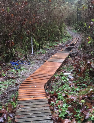
Blyth park is where things get interesting. It is a steep climb up to the top of Norway Hill. The route is an extremely narrow and twisty singletrack with dozens of sharp switchback turns and small wooden bridges. This climb will hurt no matter who you are. To my knowledge, nobody has ever successfully ridden this entire climb. On a loaded bike, you can expect to spend some time hiking. Your reward, however, is a fast, smooth and straight descent down the other side.
You’ll hit a short paved section to cross over I-405, pass a couple gas stations for resupply then back onto the Tolt Pipeline trail all the way to the Redhook Brewery in Woodinville.
Note: If you need a bike shop, Woodinville Bicycle is a short ride away along the Sammamish River Trail.
After a few beers, you cross the Sammamish River to rejoin the Tolt Pipeline Trail and up heart attack hill. The trail continues with rolling hills with a wide gravel surface.
At the point where the pipeline trail ends, you will find a steep and surprisingly treacherous paved descent. This wet and mossy road can be very slick at times. This drops you down onto W. Snoqualmie Valley Rd. From here you’ll cross over the Snoqualmie River and then join up with the Snoqualmie Valley Trail. This is a rail trail conversion with a smooth surface and easy grade. This will be a welcome change after the repeated steep grades of the past several miles.
After a few miles, the trail skirts by the edge of downtown Carnation. It’s a small town, but a few blocks off route you can find a grocery store, restaurants and convenience stores for all your resupply needs.
The route follows the SVT another 10 miles to a tunnel where it is abruptly interrupted by private land. Here, the route deviates back onto pavement and passes through the quiet town of Snoqualmie with a few restaurants and convenience store options. If you have time, a short detour to the Snoqualmie Falls view point is well worth the quarter mile detour. The route passes by the Snoqualmie Brewery where you can partake in yet another great Washington microbrew.
Shortly after Snoqualmie, the route re-joins the SVT at Mt. Si Golf Course. The golf course struggles with the local elk population so they have erected a pretty nasty gate to keep the critters out. This can be a bit challenging to navigate with a loaded bike.
A mile and a half later and the route brushes past North Bend. North Bend was made famous by David Lynch’s television series Twin Peaks. Here you can find Twede’s Café where you can get their famous cherry pie. A right turn on Ballarat Ave will take you off route, but lead you the three blocks into town. Here you can find restaurants, grocery stores, Starbucks, and motels. You can also find Singletrack Cycles for any emergency repair needs. Lastly, North Bend is home to the Brickyard Brewery, the last for quite a while.
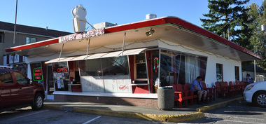
On a hot day, a stop at Scott’s Diary Freeze is a must.
After North Bend, the SVT continues another seven miles to Rattlesnake lake where it ends. Rattlesnake lake is an extremely popular summer destination. On a clear day it is worth it to ditch the bikes and enjoy the 2-mile hike to the top of Rattlesnake Ledge for some amazing views.
At this point, you have officially survived suburbia and the route ventures into the Cascades segment starting out on the Palouse to Cascades trail.
 RSS Feed
